|
|
SkyWarn Recognition Day has come and gone! I was able to contact 16 stations, for the time that I was on the air band conditions were rather weak not to mention the QSB. For my efforts I was able to print the certificate inserted below. It’s not all that big of a deal but it’s something to show for the effort. After all, one of the aspects of ham radio is communicating regardless of conditions and it was a National event to participate in.

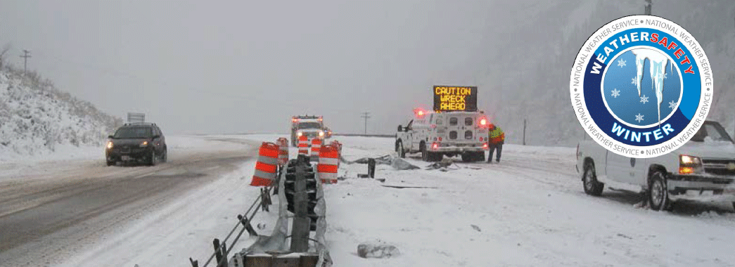
I expect that many of us have witnessed a scene very similar to the above photo. In our immediate area it is a natural event to have severe winter weather that impacts driving conditions, sometimes to the extent that we really should not be on the road. Often just postponing travel for an hour or two may enable road crews to treat the roads and give the chemicals time to take effect on the snow and ice to provide a safer traveling environment.
If you have to travel, be prepared. First off be sure you are aware of what you are getting into with severe winter weather driving. Be sure your vehicle is ready to go with a full tank of fuel and appropriate tires in good condition. Consider some additional items such as a small shovel, sand or traction mats, chains for times it gets really bad and even a very good blanket such as wool or a Mylar reflective emergency blanket. Remember to keep the cell phone charged too. Common sense helps but too often it is not so common!
Many amateur radio operators who travel have an additional resource at hand that will help with gaining a little more information about the weather. That resource can be the 2 meter transceiver which may have the capability to receive the NOAA Weather Radio announcements. Some transceivers even have a feature that will activate an alert when the NOAA radio station broadcasts their severe weather alert. Another useful service often provided through APRS digi-peaters are text alerts about road conditions that may relate to road closures due to various issues such as traffic accidents. Also some repeaters transmit bulletins relative adverse weather and road conditions.
For much more information that may make your winter and 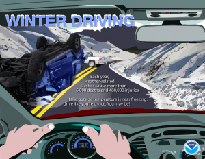
your travel safer check out the link
http://www.nws.noaa.gov/om/winter/index.shtml
 The Quad-County Amateur Radio Club is a WRN Ambassador “Weather-Ready Nation Ambassador™ and the Weather-Ready Nation Ambassador™ logo are trademarks of the U.S. Department of Commerce, National Oceanic and Atmospheric Administration, used with permission.”
It’s that time again when Mother Nature will soon shift into another season that some folks love and some hate! Winter can bring some rather enjoyable times but also some treacherous times. It is the treacherous times, with winter storms, that we have to be ready to deal with in order to make those times as safe as possible.
Winter weather issues highlighted during the week can be found by clicking the weekday tabs at: http://www.weather.gov/ctp/WinterWeatherAwarenessWeek
Be sure that your NOAA Weather Radio is operating properly and has fresh batteries in the event the electric goes out.
You can find some addition information about the NOAA Weather Radios at: http://www.nws.noaa.gov/nwr/index.php
Also remember to check out the 2015 Fall edition of the SkyWarn Spotter Newsletter at: http://www.weather.gov/media/ctp/Spotter%20Newsletters/Fall2015.pdf
The 2015 – 2016 winter outlook can be found at: https://www.climate.gov/news-features/videos/2015-16-winter-outlook
Last but not least, another site for winter weather information can be found at: http://www.nws.noaa.gov/om/winter/index.shtml
The Quad-County Amateur Radio Club is a WRN Ambassador “Weather-Ready Nation Ambassador™ and the Weather-Ready Nation Ambassador™ logo are trademarks of the U.S. Department of Commerce,
National Oceanic and Atmospheric Administration, used with permission.”
Even though hurricanes typically do not significantly impact our area, there are times when they do and it may be worthwhile to keep aware of hurricane developments.
Amateur radio is one way to keep aware with the Hurricane Watch Net on 14.325 MHz. There is also a Hurricane Watch Net web site that has quite a bit of information available. Along with keeping informed, be ready with fully charged hand-helds, a full tank of fuel for your vehicle, if you’re lucky to be high enough where flooding risk is minimal consider the possibility that you may be out of electric service for a while.
There is also more information to avail yourself at the National Weather Service/NOAA websites to be able to keep updated with the latest conditions and forecasts for hurricanes.
The following sites will help you stay informed:
http://www.weather.gov/
http://www.nhc.noaa.gov/
http://water.weather.gov/ahps/
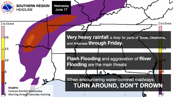
Just remember “Turn round Don’t Drown“!
The Quad-County Amateur Radio Club is a WRN Ambassador “Weather-Ready Nation Ambassador™ and the Weather-Ready Nation Ambassador™ logo are trademarks of the U.S. Department of Commerce, National Oceanic and Atmospheric Administration, used with permission.”
From ARRL:
[UPDATED 2015-09-30 @ 1940 UTC] The National Hurricane Center (NHC) has made it official: It’s Hurricane Joaquin, a Category 1 storm. But the NHC said that Joaquin is gaining strength and “could become a major hurricane during the next couple of days.” The Hurricane Watch Net (HWN) activated at 1500 UTC today (September 30) on 14.325 MHz (after nightfall, the net will convene on 7.268 MHz) to gather observer reports. WX4NHC at the NHC is not active at this time. Currently packing maximum sustained winds of 85 MPH, Hurricane Joaquin was about 190 miles east-northeast of the central Bahamas as of 1800 UTC. A hurricane warning is in effect for the central Bahamas, including Cat Island, the Exumas, Long Island, Rum Cay, and San Salvador.
“Due to the close proximity to land, whether or not this storm makes landfall in the Bahamas, the Hurricane Watch Net will be active until the storm is no longer a threat in this region,” said HWN Manager Bobby Graves, KB5HAV. “Everyone along the US East Coast should keep a close eye on this system. The current forecast brings Joaquin near the New England area by late Sunday or early Monday.”
During HWN activation, the net control station will request measured/observed ground-truth data from stations in the affected area. The HWN also remains available to provide back-up communication to official agencies, such as emergency operations centers and Red Cross officials in the affected area. The net also will gather and report to FEMA officials in the NHC any information on significant damage. Stations should not check into the net unless specifically requested to do so.
The NHC reported at 1800 UTC that Joaquin was moving toward the southwest at nearly 6 MPH. “A general motion toward the west-southwest or southwest is expected to continue through tonight,” the NHC said. “A turn toward the northwest and a decrease in forward speed are forecast on Thursday or Thursday night.The center of Joaquin is expected to move near or over portions of the central Bahamas tonight and Thursday.”
According to the NHC, Hurricane conditions are expected to reach portions of the Central Bahamas by Thursday morning. “Winds are expected to reach tropical storm strength in the warning area tonight, making outside preparations difficult or dangerous. Preparations to protect life and property should be rushed to completion,” the NHC said.
Dangerous storm surges are possible, and Joaquin is expected to produce 5 to 10 inches of rain, with isolated maximum amounts of 15 inches possible over San Salvador and Rum Cay through Friday morning.
The NHC said swells generated by Joaquin will affect portions of the Bahamas over the next few days and will start affecting portions of Florida’s eastern coast and the US southeast coast by Friday. “These swells are likely to cause life-threatening surf and rip current conditions,” the NHC predicted.
“We’re monitoring the situation and the forecasts regularly. Like most, we’re waiting to see which way the storm will go,” ARRL Emergency Preparedness Manager Mike Corey, KI1U, told the ARRL Field Organization leadership in the areas that could be affected by Joaquin. “ARRL Headquarters will be in touch with our National VOAD partners, FEMA, and NHC as things develop.”
Visit the HWNwebsite for the latest information on this storm and HWN activation plans.
Even with the bright colors and cool temperatures, Fall can also hold some rather hazardous weather too. Be prepared for the hazards that can occur during this time of year as many of us are winding down from a hectic summer.
 Click for detailed information on what various Fall weather hazards can occur and how you can prepare for a safe Fall.
The Quad-County Amateur Radio Club is a WRN Ambassador “Weather-Ready Nation Ambassador™ and the Weather-Ready Nation Ambassador™ logo are trademarks of the U.S. Department of Commerce, National Oceanic and Atmospheric Administration, used with permission.”
The tour is scheduled for August 9 beginning at 11:30 AM.
The address is 328 Innovation Blvd, Suite 330, State College, PA 16803. Upon arrival in Innovation Park, turn left and the building is the last one on the left hand side before the construction (look for the building with all the satellites on the roof). There is visitor parking right by the entrance, the office is on the 3rd floor. Since it is a weekend, the mail door may be locked, but just use the call box near the door to let them know you are there. Google maps plots the location very well and a GPS with current maps should get you there easily too.
Please email me, WA3UFN at comcast dot net, to advise that you will be attending as I need to give an approximate attendance to the National Weather Service just for planning purposes. This is open to members, family and friends. If you would like to car-pool also advise in the email, I’ll try to coordinate that aspect. We can try 146.49 simplex, as a talk around frequency while enroute or if you need assistance otherwise use the State College repeater, 146.76, access tone 146.2 Hz.
Any questions use my email as well.
The National Weather Service has issued Hazardous Weather Outlooks and Flood Watches for heavy to record rainfall for most of PA beginning late Friday. With the forecast heavy rain, water ponding and areas that may be effected by flash flooding are a concern for safety. Please be cautious while setting up your Field Day event for areas that could be effected.
Also with thunderstorms forecast remember – “When Thunder Roars, Go Indoors”.
Keep a closed watch on your area’s current weather. A NOAA Weather Radio with the alert function set up would be a good idea. SkyWarn spotter activation may be needed.
The Quad-County Amateur Radio Club is a WRN Ambassador “Weather-Ready Nation Ambassador™ and the Weather-Ready Nation Ambassador™ logo are trademarks of the U.S. Department of Commerce, National Oceanic and Atmospheric Administration, used with permission.”
Remnants of tropical storm Bill may eventually effect PA.
The Quad-County Amateur Radio Club is a Weather-Ready Nation Ambassador
When a thunderstorm rolls your way there is little you can do to protect yourself outdoors. 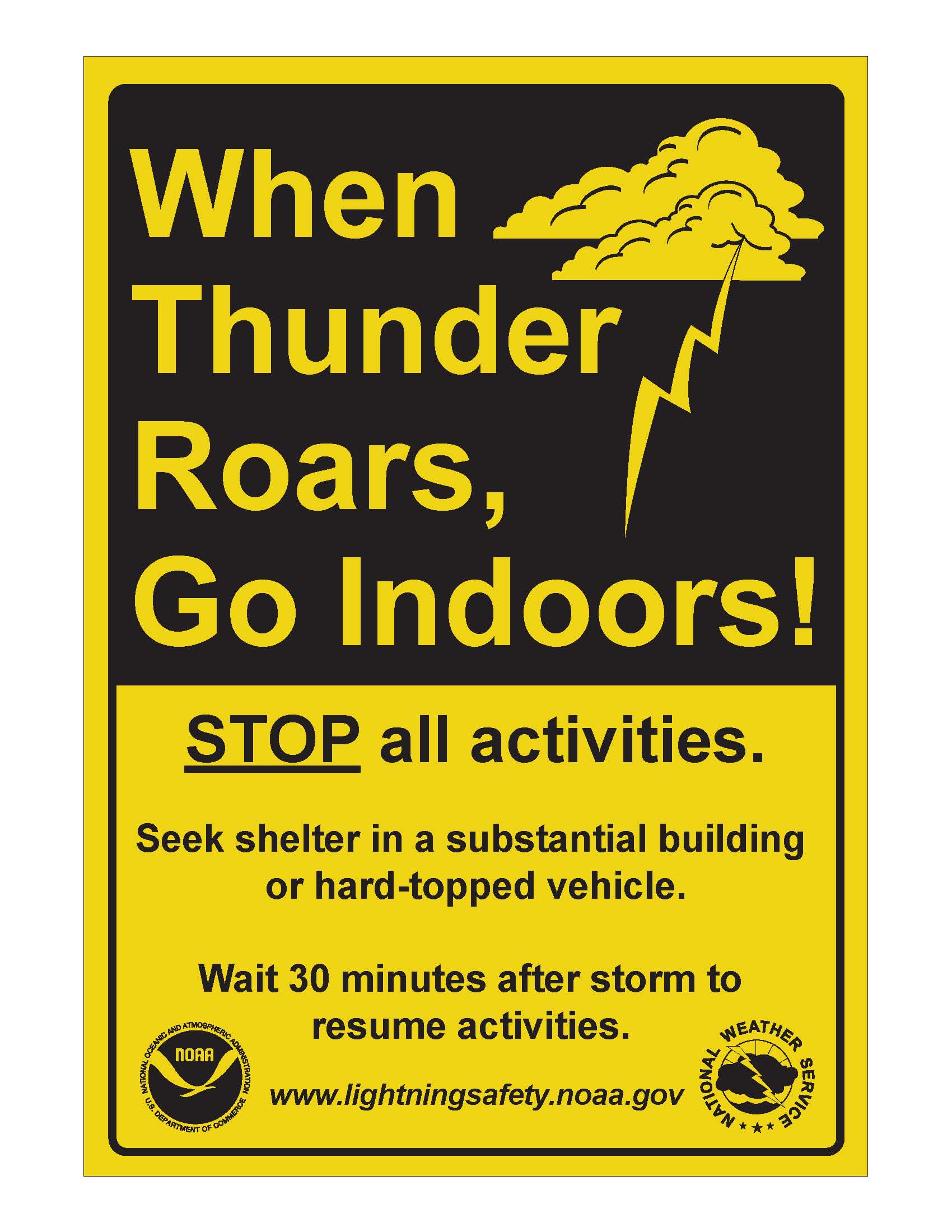 The best action is to try to move indoors or into a vehicle when you hear the first clap of thunder. NOAA Weather Radio can be you best link for severe weather information when you’re outdoors as well as indoors. The best action is to try to move indoors or into a vehicle when you hear the first clap of thunder. NOAA Weather Radio can be you best link for severe weather information when you’re outdoors as well as indoors.
Whether you’re attending a little league baseball game or a professional sporting event, the same rule applies: When Thunder Roars Go Indoors! It is never safe to be outside when lightning is in the area. weather.gov/lightning/ #LightningSafety
- Avoid open fields, the top of a hill or a ridge top.
- Stay away from tall, isolated trees or other tall objects. If you are in a forest, stay near a lower stand of trees.
- If you are in a group, spread out to avoid the current traveling between group members.
- If you are camping in an open area, set up camp in a valley, ravine or other low area. Remember, a tent offers NO protection from lighting.
- Stay away from water, wet items, such as ropes, and metal objects, such as fences and poles. Water and metal do not attract lightning but they are excellent conductors of electricity. The current from a lightning flash will easily travel for long distances.
The Quad-County Amateur Radio Club is a Weather-Ready Nation Ambassador “Weather-Ready Nation Ambassador™ and the Weather-Ready Nation Ambassador™ logo are trademarks of the U.S. Department of Commerce, National Oceanic and Atmospheric Administration, used with permission.”
Even though our immediate area is typically not seriously effected by hurricanes, as amateur radio operators we can still offer assistance when a hurricane strikes. Often times there is a need to handle traffic for the effected areas that the hurricane impacts, amateurs can assist by listening to the recognized Hurricane Watch Net frequency of 14.325 MHz for any traffic that they can process.
This year Amateur Radio station WX4NHC stationed at the National Hurricane Center will conduct its station test May 30, 14:00 UTC through 22:00 UTC. This test is to check the station equipment, antennas and other systems prior to the start of the Atlantic Hurricane Season that begins June 1 and continues through November 30. Details of the event can be read at http://www.arrl.org/news/view/wx4nhc-at-national-hurricane-center-to-conduct-annual-station-test-on-may-30
As a Weather Ready Nation Ambassador, the Quad-County Amateur Radio Club encourages everyone to take some time to read up on the hurricane information at: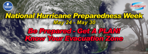
|
|